Research director:
Dr. Andreas Georgoulias
Research core team:
Cristina Contreras, ENV-SP
Hatzav Yoffe, ENV-SP
Case study written by:
Jennifer Lee, MUP 2014 Candidate
Editors:
Julie Mercier, MDes Risk & Resilience 2015 candidate
Judith Rodriguez, MAUD, MLA 2013
US $75 million investment
36.64 km long stretch
6 double tunnels, 12 bridges, four-lane roads
2.5 hours (5.3 hours before) travel time from DF to Tuxpán
16,400,000 m3 soil removed
36.6 km toll-free highway
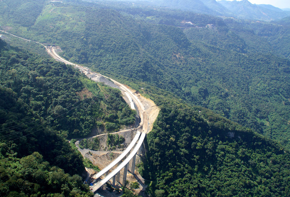
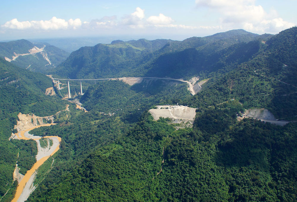
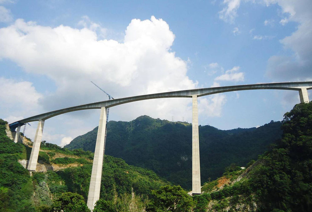
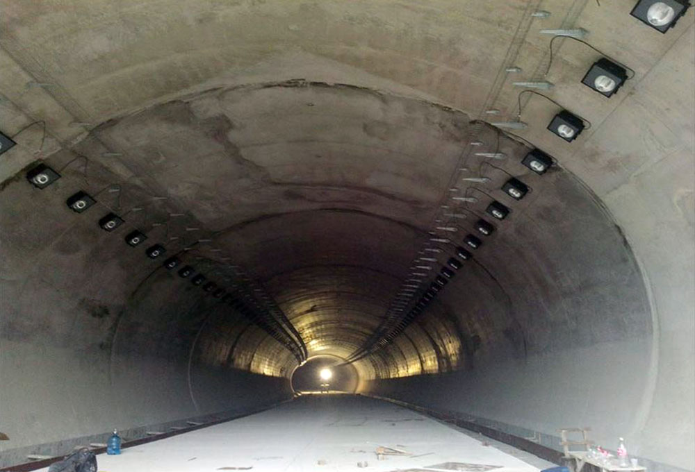
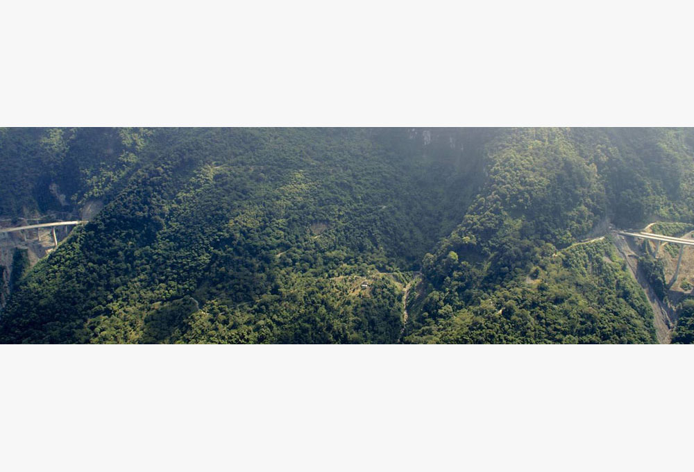
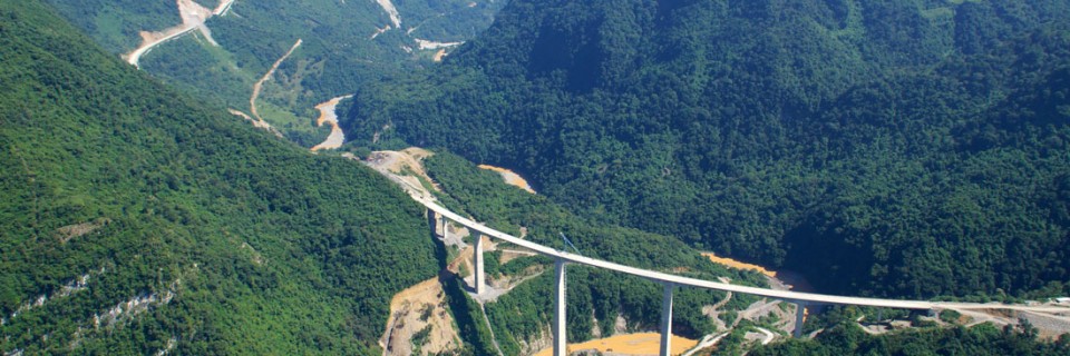
The Necaxa-Avila Camacho Highway project is a four-lane 36.64 km long section of the larger highway concession, the Nuevo Necaxa-Tihuatlán Highway, located in the states of Puebla and Veracruz in Mexico. Cutting though Sierra Oriental’s heavily mountainous and forested terrain, this project reduces dramatically the travel time of 5.3 hours from Mexico DF to Tuxpan to 2.5 hours. The highway infrastructure project consists of six double tunnels, 12 bridges, and four-lane roads, including the world’s second highest bridge pier, the San Marcos Bridge running 220 meters above the river. It also integrates sustainable techniques to reduce the negative impacts on the local communities and environment by mitigating the various social, cultural, environmental and health impacts of development through slope re-vegetation programs, hillside stabilization schemes, worker education and vaccination, and school outreach programs, among others.
This US $75 million project is developed through a unique public-private partnership strategy. The Mexican Ministry of Communications and Transportation contracted the consortium AUNETI (a consortium of the Mexican ICA, the Spanish FCC Construcción, and financial institutions such as Santander) to design, construct, operate, and maintain the project for 30 years. The larger highway concession is intended to finish the more extensive Mexico City-Tuxpan Highway, which connects up to North America from Acapulco to Mexico City to Tuxpan, and then up to Chicago and Toronto as part of the North American Free Trade Agreement.